Follow me on Twitter

Friday, September 14, 2012

Mt. Pilchuck

Hike: Mt. Pilchuck
Distance:  5.6
Time: 3 hours 45 minutes
Elevation Gain:  2200
Difficulty:  Hard
Potties:  Yes 1 at trailhead
Pass required:  NW Forest Pass

I hiked to the top of Mt. Pilchuck yesterday and it was amazing!  This hike tends to be pretty crowded so hiking it on a weekday is a great idea.  I wouldn't recommend this hike to children under 7 or anyone who has balance issues.  The trail is extremely rocky and there is a high risk of falling or twisting an ankle.

In 1918 a fire outlook was built at the top of the mountain and was staffed until the 1960's.  The supplies for the outlook had to be airlifted to the top of the mountain in order to build the shelter.  So amazing!

Here are just a few pictures of the journey:)
Rocky trail

View along the trail


Sheer rock walls all along the path

Yes, this is part of the path:0

Views from the clearing near the top

Fire outlook and the rocks we had to climb to get there

Views from the outlook


Yes, you have to climb this to get to the top:)

This is a must do hike and I think I always say that about all of the hikes I have done.  There are so many amazing hiking adventures to be had in Washington state and I feel spoiled to be able to enjoy them regularly (during the summer anyways).  If you have to pick one hike to do before the weather gets bad (I wouldn't do this in the rain or snow, too slippery) this would be at the top of my list.

To get here drive Hwy 92  to Granite Falls.  Turn left on the Mountain loop hightway and follow the Mountain Loop Highway east. One mile past the Verlot Public Service Center, turn right onto  Forest Road 42 immediately after crossing the "Blue Bridge." Drive 7 miles on the gravel road to the trailhead at the road end.

I hope you get a chance to do this hike before season's end.  Have a great day and happy hiking!

Monday, September 10, 2012

Mt. Si

Hike: Mt. Si
Distance:  8 miles
Time: 4 1/2 hours
Elevation Gain:  3150
Difficulty:  Hard
Potties:  Yes
Pass required:  Discover Pass

I have been wanting to do this hike for a couple of years now and I finally decided it was time.  I had done Little Si with the boys a few years ago and wanted the challenge of doing the big one.

I headed out with my friend Suzy early in the morning and made the hour drive to North Bend.  It was an easy drive and the parking lot was huge and nearly empty.  It was a weekday after all, which is the best time to do these popular hikes.

The trail was very well maintained and wasn't too rocky until you reached the last quarter mile.  I will say that you are basically going 4 miles straight uphill, so this hike is not for the cardiovascularly challenged.  Going uphill for 4 miles also means you have to go downhill for 4 miles which is often an even bigger job.  All in all, after all the trip reports I had read before doing this hike, it wasn't as hard as I had expected.  I loved the difficulty and felt accomplished when I reached the top.

Mt. Ranier


The views were beautiful although it was a bit hazy the day we were there.  The view above is from atop a rock scramble.

We didn't make the journey to the haystack which seemed pretty steep.  We may have tried it if we had more time and energy:)
I am happy to have accomplished hiking up Mt. Si.  It was a great challenge!  However, this isn't one of my favorite hikes.  Great for elevation gain and nice views though.  It is worth it for the accomplishment of making it to the top:)

To get here  drive east on I-90 to exit 32 (436th Avenue SE). Turn left (north) over the freeway and drive 0.5 mile to North Bend Way. Turn left (west), and in 0.25 mile turn right (north) on Mount Si Road. The  trailhead is on the left,  about 2.5 miles down the road.

Saturday, September 8, 2012

Lake Serene

Hike: Lake Serene
Distance:  7.2 miles round trip
Time: 4 1/2 hours
Elevation Gain:  2000 feet
Difficulty:  Hard
Potties:  Yes (at parking and near top)
Pass required:  NW Forest Pass

I hiked to Lake Serene yesterday with my friend Suzy.  This hike is a just off of Highway 2 a little bit past Gold Bar.

The first couple of miles were medium in difficulty, but once you reached mile 2, the rocky and steep switchbacks started.  I wouldn't recommend this hike for children under 5, and anyone with balance issues.


Look how clear the water is
There were even a couple of skinny dippers there, but I didn't take a pic:)

I took a couple more pictures along the way.

The last couple of miles looked like this.  Steep and rocky.

Here is Suzy walking on the bridge right before the lake.

Photo courtesy of Suzy:)  Me showing my upper arm strength.

This hike is a must do.  At around mile 2, there is also an option to turn off and hike a 1/2 mile to Bridal Veil Falls, which we didn't have time for today, but you can read about here.  It is definitely worth seeing.

All in all a great hike and a good challenge.  I will be making this trek again for sure and leave myself more time to linger at the lake.

To get to the trailhead, travel east on Highway 2  from Monroe, WA. At milepost 35.2, about 21 miles east of Monroe, turn right onto Mount Index Road (Forest Road 6020 - gravel). Travel 0.3 mile on Forest Road 6020 and branch right onto Forest Road 6020-109 (gravel) follow the sign that says Lake Serene. The trailhead parking is just ahead. 

Saturday, June 9, 2012

National Get Outdoors Day!

Today is "National Get Outdoors Day" where you can gain free entry to state and national parks.  Check out the free locations here and get on out there have have some fun!

Thursday, June 7, 2012

Hiking For the Older Generation


Today we have a guest post from Mary Tilken on tips for hiking  for the older generation.  Thanks Mary!

Hiking Tips For The Older Generation
Hiking is a super enjoyable activity that can be enjoyed by almost everyone. When a person hikes, he or she is able to commune with nature in a relaxing environment that can truly help clear the mind and balance the body. Not only that, but hiking is a great way to get the valuable exercise needed to stay in shape and can provide a variety of positive health benefits. If you love the feeling of enjoying a relaxing hike in the great outdoors but you feel as if you are too old to do so, remember, you are never too old to hike. Although certain special precautions may need to be taken, it is still possible to enjoy a refreshing hike even if you are an older person. If you want some tips on how you can hike safely, regardless of your age, here are some helpful tips for the older hiker.

1. Get In Shape
Before embarking on a hike full of rough terrain, you are first going to need to get your body in shape. Start slow by doing easy stretch exercises to get your body more limber. Or, try walking around the block to build leg muscle. By preparing before you take a serious hike, you can be certain your body will be able to handle any type of terrain you come across.

2. Get Good Shoes
While good hiking shoes are a necessity for hikers of all ages, they are especially important for the older hiker. Many older people have back pain or other pain issues and these problems will be made worse during a hike unless you are equipped with good hiking shoes.

3. Bring A Buddy
The woods can be an unpredictable place and if you want to ensure your safety during a hike, it is good to bring along a hiking buddy. Accidents can and do occur and it could be catastrophic if you are hiking alone when an accident occurs. There is safety in numbers so be sure to bring a friend to help out in case injury occurs. Plus, it's fun to have someone to talk to and share nature experiences with so bringing a buddy on a hiking adventure is just an all around good thing.

4. Take It Easy
If you are an older hiker who does not have a lot of hiking experience, it is best to tackle easy hiking spots before attempting more advanced one. Once you can work yourself up to feeling confident enough to take on rougher terrain, your body will definitely let you know it's okay.

5. Talk To Doctor
As with any exercise regime, it is best to consult with your doctor. Your doctor can run tests on your body function so to be sure that hiking will not cause your heart or other body parts any unneeded troubles.

Hiking is a fun and enjoyable outdoor activity that can provide hours of good times. If you are an older person who has been considering taking up hiking yourself, following the above hiking tips for older individuals will be sure to provide that your hike is safe and enjoyable.

Marta Tilken writes about fitness, the great outdoors and saving money at http://homeequityloan.net.

--
Guest Post U
The University of Great Content

Monday, May 21, 2012

Boulder River


The weather has been really nice here in Seattle (until yesterday) so I made sure to take advantage and be active outside instead of in the gym.   I decided to go on a hike with a friend, to Boulder River just past Arlington WA.  The weather was a little cloudy but ended up being sunny and perfect weather for a hike.  There were only 2 other cars parked at the trailhead so we practically had the place to ourselves.  The total mileage for this hike is 8.6 miles, but with our time constraints (had to pick kids up from school), we only made it 7 miles round trip.  Oh well, maybe next time:)

This is the 3rd time I have attempted this hike.  Here, you can read about the 1st time and 2nd time and find directions to Boulder River.

The best part about this hike is that it can be done year round.  With many hikes here in Western Washington, you have to worry about snow covered trails well into June and even sometimes July.  This hike is almost guaranteed to be snow free unless you do it in the middle of winter.  Love it!

I hope you get a chance to visit this hiking destination.  It's well maintained and is much less crowded than many of the better known trails.  The views are amazing and hopefully one day, when I have more time, I will actually make it to the top:) 

Have a great day and happy hiking!
Twin Falls

Boulder River

There was some sort of photo shoot going on down there.


Monday, April 16, 2012

Pihea Trail Kauai

Long time no see.  I have been so slacking on my hiking challenge and I hate it!  The weather has prevented much hiking around my neck of the woods and I miss it so badly.  Being in nature, the sounds, the smells, being away from the stresses of everyday life.  I feel like I am having hiking withdrawals.  I also sometimes get frustrated because I don't feel safe hiking alone and I don't really have a hiking buddy.  I guess I need to just start forcing people to come with me.  Maybe I will tell them we are going for coffee and just drive for an hour  to the hiking trails:)  Is that considered kidnapping?

Anyways, for my 3rd hike in my 12 hikes in 2012 challenge I am going to tell you about the Pihea Trail in Waimea Canyon, Kauai.  The most beautiful place on earth.  Kauai is my favorite place.  Since I love to be active, this is the perfect place for me to be.  Snorkeling, hiking, horseback riding, swimming, etc. 

The Pihea trail is approximately 2 miles one way from the Kalalau Lookout to the Alaka'i Swamp Juncture, but you can continue on to the Kilohana Lookout for 3 more miles to make it 8 miles round trip if you want.  We didn't have time for that this time.

The trail is well maintained and was quite busy the day we were there.  After the first mile you will steadily incline until you reach your destination.  I would consider this hike moderate in difficulty since some spots are quite rocky with roots galore.  You will want to watch your step and be careful especially when coming back down.

I didn't take any pictures of the actual trail, but look at these amazing views!


Make sure you bring enough water since it is guaranteed to always be pretty warm.  Can you imagine anything better than this? 

There are bathrooms in the parking area at the Kalalau Lookout and don't worry, there are plenty of spots to stop and take in the views.  I would definitely take children on this hike, but I think anyone under 5 would have a hard time with the elevation gain and the rocky path towards the top.

To get here take Hwy. 56 South until it merges into Hwy 50. Drive all the way south and west past the town of Waimea until you see Waimea Canyon Drive (Hwy. 550) to the right. It is a rather unassuming road and you have to watch for it. Go right and up and up onto Waimea Canyon Drive until you enter Kokee park and go to the park headquarters to get more information on the park's trails.

I hope to get a hike in soon in Oregon, Vancouver, and Nevada.  If you have a favorite hike in one of these spots, let me know.  I love to hear about your adventures and favorites!

Have a great day and Happy Hiking!

Wednesday, February 29, 2012

Hike #2 Camelback Mountain Scottsdale AZ

Well, if you read my blog, Livin the Fit Life, you know that we didn't make it to Spain to hike Montjuic and the weather in Italy and Switzerland definitely didn't lend to hiking.  So, for my second hike in my 12 in 2012 hiking challenge, here is a nice warm hike for your reading pleasure.

Camelback Mountain in Scottsdale AZ is a short but challenging hike up steep and rocky terrain.  The mountain got its name because it looks like a camel laying down. We chose to do the Camelback Mountain Echo Canyon Summit Trail which is the more challenging of the 3 options.  It was a beautiful sunny day while we were there.  A little warmer than I am used to, being from Seattle.  We actually stayed at the Camelback Inn so we were within walking distance to the mountain.

We arrived at the mountain in the afternoon and despite the heat, there were many other hikers there.  We even saw one lady running up the steep mountain and I couldn't believe what I was seeing.  As we climbed the rocky staircase at the base of the hill, we saw several rock climbers climbing up the giant boulders that surrounded the base of the mountain.
I actually had met with a trainer at the resort for a leg workout today which probably wasn't the smartest idea in the world.  This mountain climbs 1200 feet in just over 1 mile and it is so steep there is a handrail  to hold onto.  I highly recommend using it, especially when you are heading back down.  

We passed several lizards on the way up like this one here.
The panoramic views at the top were beautiful and we stayed there for a while just enjoying the scenery and the heat.


After a while, we hiked back down and my legs were so wobbly that they felt like they were going to give out on me.  Note to self:  Don't do an hour long leg workout right before climbing a steep mountain.  I definitely used the handrail on the way down!

This hike was great on so many levels.  Although it was only about 2.4 miles round trip, it was a very challenging ascent and descent.  Sometimes, for me, the downhill is harder than the uphill.  The views were amazing and I loved seeing the lizards.  Being from Seattle, I love to see different plant life and wild life than what I am used to at home. It makes for a really fun experience.

This would be challenging for children under 8.  The footing is difficult and it is very steep.  If you aren't used to strenuous exercise, make sure to take lots of breaks.  Also, be sure to bring plenty of water and wear sunscreen.  You will be in direct sunlight much of the way and you don't want to get burnt or dehydrated.  Also, this is rattlesnake area so be sure to stay on the path and be aware of your surroundings.

There are port-a-potties at the trailhead.  If you are in the Scottsdale area, this is a must do hike.  Please take some time and check it out.  During peak season (October to April) the parking lot gets crowded quickly so be prepared.  There wasn't a fee to park when we did this hike.

Location:   5700 N. Echo Canyon Parkway, about 10 miles northeast of downtown Phoenix.

To get to the Echo Canyon Recreation Area: Take McDonald Drive east about 1/10-mile from Tatum Boulevard in Paradise Valley. Turn onto Echo Canyon Parkway, which is on the south side of McDonald Drive. Note: you will still be driving on a residential street at this point. It will be about a ¼-mile drive to the trailhead parking area.

Stay hydrated and happy hiking!
 

Friday, January 27, 2012

San Jacinto State Park Palm Springs CA

The first hike of my "12 in 2012"  hiking adventure is at the San Jacinto State Park in Palm Springs, CA.

When we asked residents of Palm Springs the best place to go, they responded San Jacinto Aerial Tramway.  So, that's where we decided to go.  This wasn't a strenuous hike since we used the tram to get to the trail.  You can choose to do the 4 mile round trip hike to Round Valley or the 11 mile round trip to San Jacinto Peak. We chose the 4 miler with an elevation gain of only 600ft.

Once you get to the parking lot, you will enter the tram terminal where you will pay $23.95 per adult and $16.95 per child.  Ouch, that's a bit steep, but this was our plan for the day, so we continued.


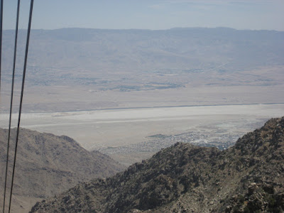
After you pay you will get in line to enter the tram (didn't take too long) and you are off.  The one thing that really threw me off was the fact that the inside of the tram was spinning the entire ride.  Very slowly, but in order for everyone to get a great view, the floor of the tram spun.  This was a bit off-putting especially if you were afraid of heights as you had to continue to change your grip on the handrails in order to hold on.  Also, if you are like me, this can cause a bit of motion sickness.  I actually took a half of a Dramamine just in case.


The aerial tram takes you up 2 1/2 miles to the Mount San Jacinto State Wilderness Park.  At the top there is a building with souvenirs, bathrooms and even a restaurant.  We decided to eat at the restaurant first to beat the lunch crowd.

Then we were finally off on our hiking adventure.  It was extremely hot while we were in Palm Springs, but by the time we got off the tram, the temperature dropped about 20 degrees due to the elevation.  So, we had to put our coats on.

The hike is fairly flat except for the steep cement walkway you encounter the first and last 1000 or so feet at the beginning and end of the hiking path.

The views were beautiful and the path was well maintained.  We came across a tiny stream and some huge and amazing rocks to climb on and see some beautiful mountain and valley views.  We completed the loop in about an hour and 15 minutes and had a great time.  We even saw a gray squirrel with the biggest, fluffiest tail you have ever seen.  We found out it was a gray squirrel because they had a tiny museum of stuffed native animals on display.  Pretty neat.


All in all a fun hike with great views.  The boys loved the tram and both got something fun in the souvenir shop.  The price tag was a bit steep for my blood, but it was a great experience so I guess it was worth it.

Our ride back down.
To get here from Interstate 10, exit on California Hwy 111 (the road to Palm Springs). Proceed nine miles to Tramway Road, turn right, and follow the road 3.5 miles to its end at Valley Station.

There are bathrooms at the parking lot station and at the top.  Bring a jacket since the temperature decreases quite a bit when you get to the top.