Riley and I ventured to Goat Lake off of the Mountain Loop Highway near Darrington last week for a 10 1/2 mile hike. He was up for it and did an amazing job! While driving there I felt like we were seriously going into the middle of nowhere. This picture was shot from the dirt road leading to the trailhead.
I would rate this hike as medium in difficulty as far as the trail conditions and elevation with a gain of only 1300 feet. However, I would rate it hard as far as the distance traveled. So, I wouldn't recommend this hike for anyone under 9 years old.
The trail starts out in a new growth forest and you can hear Elliot Creek flowing after about a half mile. You will have to make a decision at the fork whether to take the upper or lower trail to Goat Lake. We took the lower trail to the lake and the upper on the way back. That way we didn't miss anything.
There were many blowdowns on the lower trail most of which didn't affect the trail.
Most of the way Riley and I could walk together, there are some areas where you will need to walk single file.
You will see some great waterfalls along the lower path.
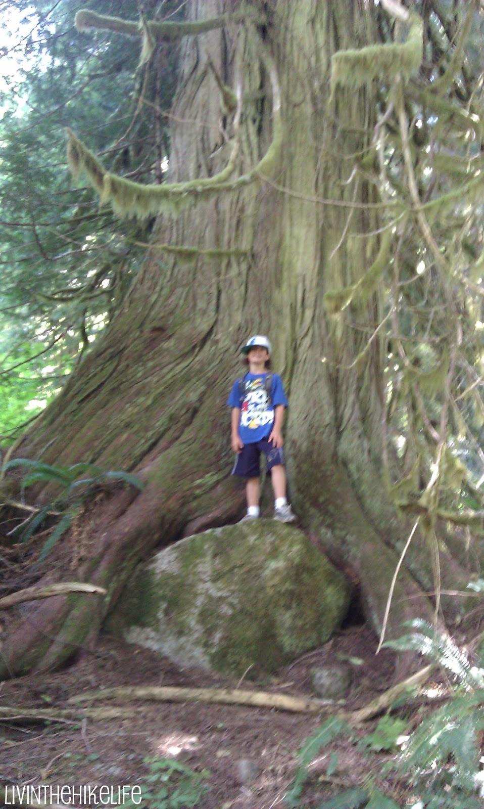
At about 3.5 miles you will merge with the upper path and enter the old growth part of the forest. I love these ancient trees that have been standing so long. They are amazing!
I took so many pictures of these amazing trees and wish I could post them all. At about 4.5 miles you will see a dry creekbed and you will cross it to the right to enter the forest again.
You will then take a sharp left at this stump and head up the rocky hill.
A short while after the turn you will hear roaring McIntosh Falls and you can take a slight detour to view the falls. They are majestic.You are almost there. Just about 1/2 mile left. Right before you reach the lake you will see this sign and you will go straight to the lake.
After walking through a trail of greenery, you will finally reach the lake. It was definitely worth it.
We stayed here about 1/2 hour and had lunch before we had to head back down. It was so peaceful. We only saw 4 other people while we were there.
Now time to head back down. We went straight to the upper trail this time when we hit the fork.
The upper trail is like a whole different hike. The path was a bit narrow at some points.
Riley had to hold up this blown down tree for us to pass.
There was a rock slide about 1 mile into the upper trail that we had to go around, not too bad.
There were quite a few bugs. I used a bug repellent bracelet that didn't seem to work real well but probably was better than nothing. It took us 5 hours from start to finish including our lunch break at the lake. We would have stayed longer if we didn't have to drive an hour and a half to get back home.
To get here, drive the Mountain Loop Highway East from Granite Falls. You will pass the Verlot Ranger Station on the left. This hike does require a Forest Pass, so you can stop at the Ranger station if you don't already have one. Continue past the Ranger Station for about 19.5 miles to Barlow Pass (end of the paved road) and enter a gravel road. You will drive on this dirt road for about 4 miles and cross the Elliott Creek Bridge. About .2 miles after the bridge, you will turn right on road No. 4080 and drive for about a mile to the trailhead.
There is a great outhouse at the parking lot that seems pretty new. It smells of cedar which covers up any other bad smells that may linger. I had to add a picture. I love myself a nice bathroom. There was even a hand sanitizer dispenser that was full!
Overall, this was a great hike. Challenging distance, not too steep, and beautiful surroundings. The path was easily traversed and Riley was able to keep up with me no problem. The lake was spectacular and the views of Cadet Peak were snow capped.


No comments:
Post a Comment