On August 25th the boys and I headed to Barclay Lake off of Highway 2 near Baring. We were all in the mood for an easy hike today and according to my sources, this was an easy one. With a distance of 4 1/2 miles and only 200 ft. of elevation gain this one seemed to fit the bill. It took us 1 hour to hike to the lake and about 50 minutes to get back to the trailhead.
Although this hike wasn't too steep, the path was rocky and had exposed roots in many spots. I felt it was closer to moderate in difficulty for little feet.
We entered the trailhead and immediately were enveloped by the trees.
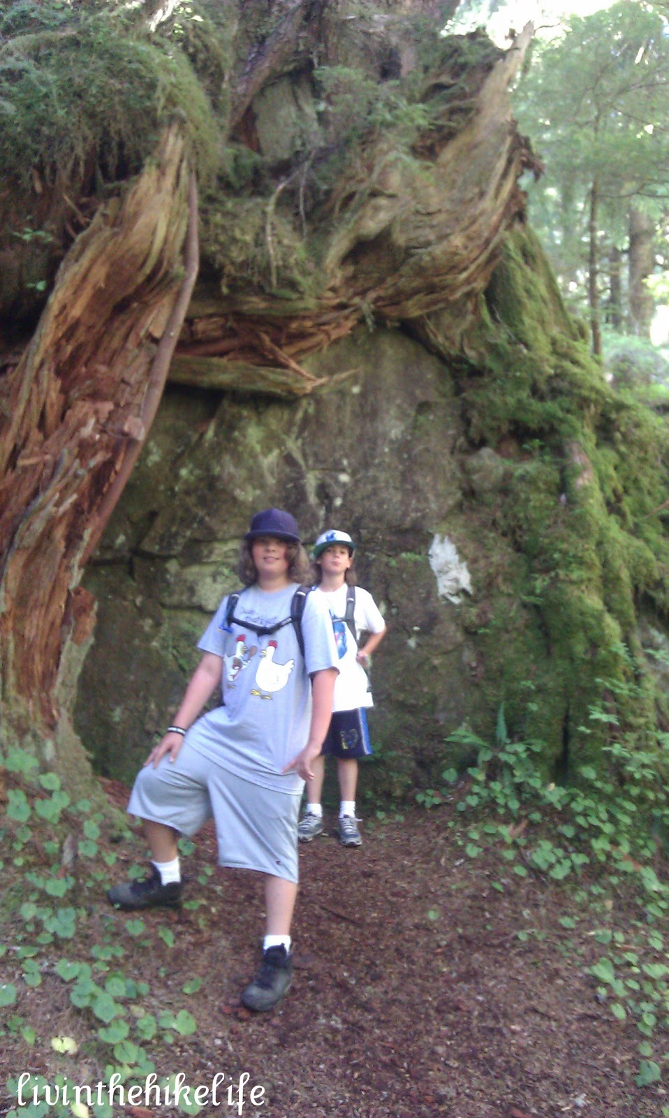
The most interesting part of this hike for us were the huge rocks that had trees growing around them. There were many of them and it is not something you see every day.
The boys even climbed to the top of one.
You can tell that this forest has a high amount of precipitation by the moss that covers pretty much everything. It is like a lush green carpet.
About 1/2 mile from the Lake you will cross the bridge over Barclay Creek. We passed a huge crowd of people lingering here on their way back to the trailhead.
Walk a little further and you will reach Barclay Lake. This is a popular camping area and you may pass people camping along the way. Continue along the path and find your own secluded beach area. Lucky for us, we got a late start and most people were on their way down when we got there. We snagged a great spot on the lake and had a fun time playing in the water and having lunch. Make sure you bring your swim suits on a hot day.
The views on the lake were beautiful and you have a clear shot of Baring Mountain across the way.
This has become one of our favorite spots. I can envision ourselves coming in the morning and spending the entire day lounging and playing in the water. It was so relaxing, we didn't want to leave.
On the way back to the trailhead we stopped on the bridge to listen to the gurgling creek.
To get here you will drive East on Highway 2 to Baring. Turn left on 635th place (near milepost 41) crossing the railroad tracks. After .3 miles, you will turn left on forest road 6034. You are now on a gravel road and you will continue for about 4 miles to the trailhead. A forest pass is required to park at the trailhead. There are 2 honey buckets in the parking lot. One was out of toilet paper, luckily I had some in my hiking essentials kit.


No comments:
Post a Comment