Follow me on Twitter

Showing posts with label Forest Pass. Show all posts

Thursday, September 8, 2011

Tonga Ridge


small business home business
Well, the kids went back to school this week.  So, on September 1st we did our last hike before school started to Tonga Ridge off of Highway 2.  This is the hike we were planning to do at the beginning of the summer, but got snowed out.  So we tried again last Thursday and there was no snow in sight.

This hike is 6 miles round trip with an elevation gain of 1200 feet. It took us about 2 1/2 hours to complete.

A forest pass is required and there is no outhouse at the trailhead so you might want to stop at the Skykomish ranger station first.

There were a few blowdowns at the beginning of the hike that were easy to get around.

You will start off in the forest among the trees.  What we thought was interesting is that many of the trees grew sideways at one point and then grew upright again.  I researched why this might happen and found that maybe this was a high wind area.  If you have any other ideas let me know.

After about a mile the forest opens up and you will enjoy beautiful views of the mountains the rest of the way.


You also will hike along a path filled on both sides with wildflowers.  We could hear the hum of the bees the rest of the way.  No stings though.

At about 2 miles you will see a serene meadow on your left.
 Keep your eye out for a pink ribbon tied to a tree on your left.  We passed this and went on but didn't have time to turn here on the way down.  You can take a left at the ribbon and hike to a lookout point.

There are many paths you can turn off of on the left that will take you to other lookout points.  We turned off of the path and had great views of the mountains to the south.

The best part of this hike are the views.  You can see majestic and snow capped mountains almost the entire way.  The wildflowers are so colorful and the buzzing bees added to the experience.

Tonga Ridge is hikeable by most ages.  The trail is well maintained but can be quite narrow in some places with steep edges.

I have read trip reports telling of bug issues, but we had no trouble while we were there.  I did have a battery powered bug repellant fan that may have helped.  However, the only bugs we saw were the bees.

To get here drive Highway 2 east 1.8 miles past Skykomish and take a right on Foss River Road no. 68.  (you will be driving on a gravel road the rest of the way to the trailhead) After about 2.5 miles turn left on road no. 6830.  Drive another 7 miles and turn right on road no. 310.  Go another 1.5 miles to the road's end at the trailhead.  This is not much of a parking lot just basically the end of the road.

Sunday, July 31, 2011

Bridal Veil Falls

All I can say is WOW!  We went to Bridal Veil Falls near Index WA on July 28th and it was amazing! This is about a 5 mile hike medium in difficulty.  The trails are quite narrow with some mud and water over the walkway.  Some areas are also rocky so watch your step.  I wouldn't recommend bringing anyone under 5 years old.


Don't let the trail fool you.  It was narrow with lots of bugs and not fabulous views.  The forest was nice and quiet with birds sounding in the distance.


You will walk through the forest for about 1 1/2 miles and the trees open up to amazing views of the tree and snow filled mountains.  My boys just wanted to sit there and enjoy the view for a while.


After this viewpoint you will walk a bit further and see a sign that points right for the falls and left for Lake Serene ( about 2 more miles with strenuous switchbacks).  We stayed to the right for today.

You will notice as you continue up that the temperature slowly cools and you know you are getting close.  You will pass a moss covered rock on the right and then you will hit the STEPS.


We counted 187 on our way.  Whenever I count stairs I always seem to be off by a few.  See how many you can count and let me know how close we were.

As I took pictures the boys got a lead on me and all I hear is them yelling "Oh my gosh mom!  You have to see this."  This must be good!

So I continued up to the top and they were right! Amazing!  We were so close, we could feel the cool mist on our faces and could touch the icy water!


These pictures and videos can never show the true majesty and beauty of God's creations.  Just know that everything posted here is even more beautiful in person.  My oldest son said that this is the best hike yet and we have done many.  I always tell my kids when we see these awesome sights that  you have to work hard to experience the best life has to offer and this is a perfect example.  We sat for about a half an hour just watching the falls before we had to go back down.  We didn't want to leave.


To get to the trailhead, travel east on Highway 2  from Monroe, WA. At milepost 35.2, about 21 miles east of Monroe, turn right onto Mount Index Road (Forest Road 6020 - gravel). Travel 0.3 mile on Forest Road 6020 and branch right onto Forest Road 6020-109 (gravel) follow the sign that says Lake Serene. The trailhead parking is just ahead.  A Northwest Forest Pass is required to park at the trailhead. There are two potties in the parking area (pretty fresh when we were there). 
Check out my post on Where to buy your Forest Pass

I hope you enjoy this hike as much as we did.  We made a couple of really fun stops on the way home that I will ad in a new page called "fun stops on the way".  Keep your eyes peeled. 

I always like to hear your comments, so if you have a favorite hike, comment, or question, let me know!  You can also get email notifications when I make a new post by following me by email at the top of the page.


Saturday, July 30, 2011

Where to buy your Forest Pass

There are many trailheads that require a Northwest Forest Pass.  This pass allows you to park at the trailhead and the money from the purchase of these passes goes towards maintaining the trails that we use.

You can purchase a day pass for $5 or you can purchase a yearly pass for $30.  If you think you will be doing 6 or more hikes per year, the yearly pass is definitely worth it.  Even if you don't, the money goes towards preserving our trails and it keeps you from having to purchase a pass every time you go on a hike. You can check here to see if your hiking location requires a pass Locations Requiring a Pass.

For example, on our last hike, I had to drive past our destination to go to the ranger station and purchase a pass.  I decided to purchase a yearly pass so I didn't have that problem again.  Here is what a yearly pass looks like.

You can purchase a forest pass at any ranger station and online at Forest Pass Online.  Check here for local vendors in your area  Forest Pass Vendors. Other places that you can purchase a  pass include:

REI
Sports Authority
Big 5
Fred Meyer

Most sporting goods stores should have these available.  Happy Hiking!

Wednesday, July 27, 2011

Lake 22

What a great day for a hike!  We went to Lake 22 on July 18th.  Not too hot, not too cold.  One thing about hiking is that the weather can change mid hike because of the elevation, so we always bring jackets just in case.  Beware, this post contains lots of pictures.


Because the trail is well used, some areas have exposed roots and are quite rocky.  This makes it hard for little feet, so I would stick with children over 7.  There are also some areas with water over the walkway so watch your step.


The trail stretches about 5 1/2 miles round trip and the elevation gain is 1300ft. on the way up, so there are some tough sections.  There was a bit of snow towards the top, but nothing unmanageable.

Nature was at its finest.  We even saw a chipmunk on the way.


The scenery was beautiful, with ancient  cedar trees and rushing waterfalls the entire way.


Once you get to the top, everything opens up and you see a lake that seems to make its own shade of bluish green.  When we were there the lake was still covered in slush.


The boys tried to break up the slush by throwing rocks at it.  I don't know about your kids, but mine could throw rocks in the water for hours (maybe a boy thing?). 

This hike is a must do.  The boys had a great time and the scenery is amazing! We will definitely do it again.  I would say the trail is hikeable most years June through October.  However this year June may have been a bit snowy due to the weather.

To get here drive past Granite Falls and follow the Mountain Loop Highway east for 11 miles to the Verlot Public Service Center. Proceed 2 more miles to the trailhead, on your right. You will need a wilderness pass so you can stop at the Verlot ranger station on the way. The trailhead parking lot does have potties.

Thursday, July 21, 2011

Iron Goat Trail

Our first hike of the summer was supposed to be to Tonga Ridge on July 11th.  Unfortunately when we arrived at the Skykomish Ranger Station to get our wilderness pass, we were told that this trailhead was snowed in and they gave us another option, the Iron Goat Trail. You can check the history of the trail out at
http://www.irongoat.org/ .  It is pretty interesting.

We went with another mom and her 2 boys which makes it more fun for the kids that they get to go with their friends.  This was more of a walk through the woods rather than a hike since it was pretty near flat the entire way, but it was beautiful and about 6 miles round trip.  We actually went to the first trailhead turnoff when we were supposed to go to the second one that is marked with a red train caboose.  This makes sense since the trail is an old railroad tunnel.  Parts of the tunnel are still there and they are amazing!  This is a great hike to do on a hot day since you can feel the cool breeze from the exposed tunnels and the cold air from the access tunnels.


This trail is easy for small children and stroller and wheelchair accessible.  There was one small 6 ft section that still had a bit of snow, but the rest is flat and well maintained.  Actually the day we were there, a maintenance crew was weedwacking and clearing the path to keep the path well maintained.  Not as peaceful, but much appreciated.

To get here take the Stevens Pass Highway, U.S. 2, to Milepost 55, 6 miles east of the town of Skykomish or to Milepost 58.3 at Scenic (5.6 miles west of the summit). Turn north on to the Old Cascade Highway, U.S. Forest Service (USFS) Road #67. Proceed to the junction with USFS Road #6710 (2.3 miles from Milepost 55 or 1.4 miles from Milepost 58.3). Turn onto USFS Road #6710 and proceed 1.4 miles to the Martin Creek trailhead parking lot.

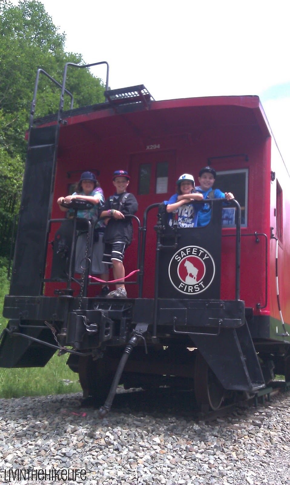
The above directions go to the trailhead we parked at and we liked this way the best. You hit the turnaround at the caboose and the kids enjoyed playing on it before we turned around  and hiked back.


You do need a wilderness pass to park here.  You will want to stop at the Skykomish Ranger Station on your way.  The pass is $5 and is good for the day.  You can buy a yearly pass which is $30. 

There is a bathroom at the ranger station and at the trailhead and turnaround for those of you with children (who are we kidding, moms too).

 Be sure to check out this link USDA forest service website before you head out to make sure trail conditions are good.  Many of these trails are only accessible May-October.