In my need to get a little more exercise in, we stopped at Deception Falls on the way home from Lake Janus. About 15 miles west on Hwy 2 you can take a right into the parking lot for Deception Falls. The boys were not very excited about this since they had already taken their wet shoes and socks off but they begrudgingly got out of the car.
The boys enjoyed crossing the stream along the trail.
We found a tree that looked like it had a face on it.
This is more of a walk than a hike since it is only 1/2 mile (also a .2 mile option), but it is amazing! I don't know that I would make the long drive to just see this, but it is definitely a must see if you are in the area.
A wilderness pass is not needed to park in the parking lot and there are potties (really stinky when we were there). The boys were extremely happy that we ended up stopping and said they wanted to bring their friends next time.
This is very child friendly, even for very young ones. The trail is well maintained but is not stroller or wheelchair accessible due to stairs leading to the viewpoints.
From Everett, drive east on US-2, 10 miles east of Skykomish to the Deception Falls Picnic Area (located 8 miles west of Stevens Pass.)
This is a family oriented guide to hiking and staying fit in the Pacific Northwest and beyond.
Showing posts with label Stevens Pass. Show all posts
Monday, July 25, 2011
Friday, July 22, 2011
Lake Janus
Well, we ventured to Lake Janus today (July 22nd) off of Highway 2 Stevens Pass east. The trail is 7 miles round trip. According to my sources, this is best traversed mid July to October. So, I should have known, since our summer has been terrible that the trail was not ready for us. We made it about 1 mile before the snow overtook the trail and we could go no further. There was mud and water most of the way, so our shoes were soaked by the end.
We did make it to a nice viewpoint where there was a pond/swamp area. I noticed a lot of bugs while we were there because of the standing water so I would suggest using bug repellent or using a bug bracelet.
I would suggest making this trek in August or September to make sure the trail is dry and the snow is mostly melted. This trail is medium in difficulty and I wouldn't suggest bringing young children. My boys are 9 and 11 and they were fine. The trail is uphill and steep in some areas with an elevation gain of 1100 feet. I was very unhappy that we were unable to finish what we started, but I figured it was better to turn around than have to spend the night in the snow after getting lost.
You do not need a wilderness pass to park at the Smith Brook trailhead. There are also no potties, so I would stop at the Skykomish ranger station on the way and use the restroom there (aka stinky port a potty).
To get to the Smith Brook trailhead you take US2 East about 55 miles. You will pass the Skykomish Ranger Station on the way. Turn left on the Smith Brook Road NO. 6700. You will stop at the stop sign and go straight across US2 West continuing on Smith Brook Road. You will drive this road (mostly dirt) for 3 miles and reach the trailhead on the left.
I suggest whenever taking a hike in the wilderness to sign in on the log book at the entrance to the trailhead. You will enter the number in your party and the date just in case something happens. When you return to the trailhead, sign out and the park ranger will know you have arrived safely. This is a great safety precaution just in case.
My boys favorite part was when we got back to the trailhead. Here is a clip.
We plan to do this hike again towards the end of summer so keep your eyes out.
On the way home we did stop at another destination hike that I will post soon.
We did make it to a nice viewpoint where there was a pond/swamp area. I noticed a lot of bugs while we were there because of the standing water so I would suggest using bug repellent or using a bug bracelet.
I would suggest making this trek in August or September to make sure the trail is dry and the snow is mostly melted. This trail is medium in difficulty and I wouldn't suggest bringing young children. My boys are 9 and 11 and they were fine. The trail is uphill and steep in some areas with an elevation gain of 1100 feet. I was very unhappy that we were unable to finish what we started, but I figured it was better to turn around than have to spend the night in the snow after getting lost.
You do not need a wilderness pass to park at the Smith Brook trailhead. There are also no potties, so I would stop at the Skykomish ranger station on the way and use the restroom there (aka stinky port a potty).
To get to the Smith Brook trailhead you take US2 East about 55 miles. You will pass the Skykomish Ranger Station on the way. Turn left on the Smith Brook Road NO. 6700. You will stop at the stop sign and go straight across US2 West continuing on Smith Brook Road. You will drive this road (mostly dirt) for 3 miles and reach the trailhead on the left.
I suggest whenever taking a hike in the wilderness to sign in on the log book at the entrance to the trailhead. You will enter the number in your party and the date just in case something happens. When you return to the trailhead, sign out and the park ranger will know you have arrived safely. This is a great safety precaution just in case.
My boys favorite part was when we got back to the trailhead. Here is a clip.
We plan to do this hike again towards the end of summer so keep your eyes out.
On the way home we did stop at another destination hike that I will post soon.
Thursday, July 21, 2011
Iron Goat Trail
Our first hike of the summer was supposed to be to Tonga Ridge on July 11th. Unfortunately when we arrived at the Skykomish Ranger Station to get our wilderness pass, we were told that this trailhead was snowed in and they gave us another option, the Iron Goat Trail. You can check the history of the trail out at
http://www.irongoat.org/ . It is pretty interesting.
We went with another mom and her 2 boys which makes it more fun for the kids that they get to go with their friends. This was more of a walk through the woods rather than a hike since it was pretty near flat the entire way, but it was beautiful and about 6 miles round trip. We actually went to the first trailhead turnoff when we were supposed to go to the second one that is marked with a red train caboose. This makes sense since the trail is an old railroad tunnel. Parts of the tunnel are still there and they are amazing! This is a great hike to do on a hot day since you can feel the cool breeze from the exposed tunnels and the cold air from the access tunnels.
This trail is easy for small children and stroller and wheelchair accessible. There was one small 6 ft section that still had a bit of snow, but the rest is flat and well maintained. Actually the day we were there, a maintenance crew was weedwacking and clearing the path to keep the path well maintained. Not as peaceful, but much appreciated.
To get here take the Stevens Pass Highway, U.S. 2, to Milepost 55, 6 miles east of the town of Skykomish or to Milepost 58.3 at Scenic (5.6 miles west of the summit). Turn north on to the Old Cascade Highway, U.S. Forest Service (USFS) Road #67. Proceed to the junction with USFS Road #6710 (2.3 miles from Milepost 55 or 1.4 miles from Milepost 58.3). Turn onto USFS Road #6710 and proceed 1.4 miles to the Martin Creek trailhead parking lot.
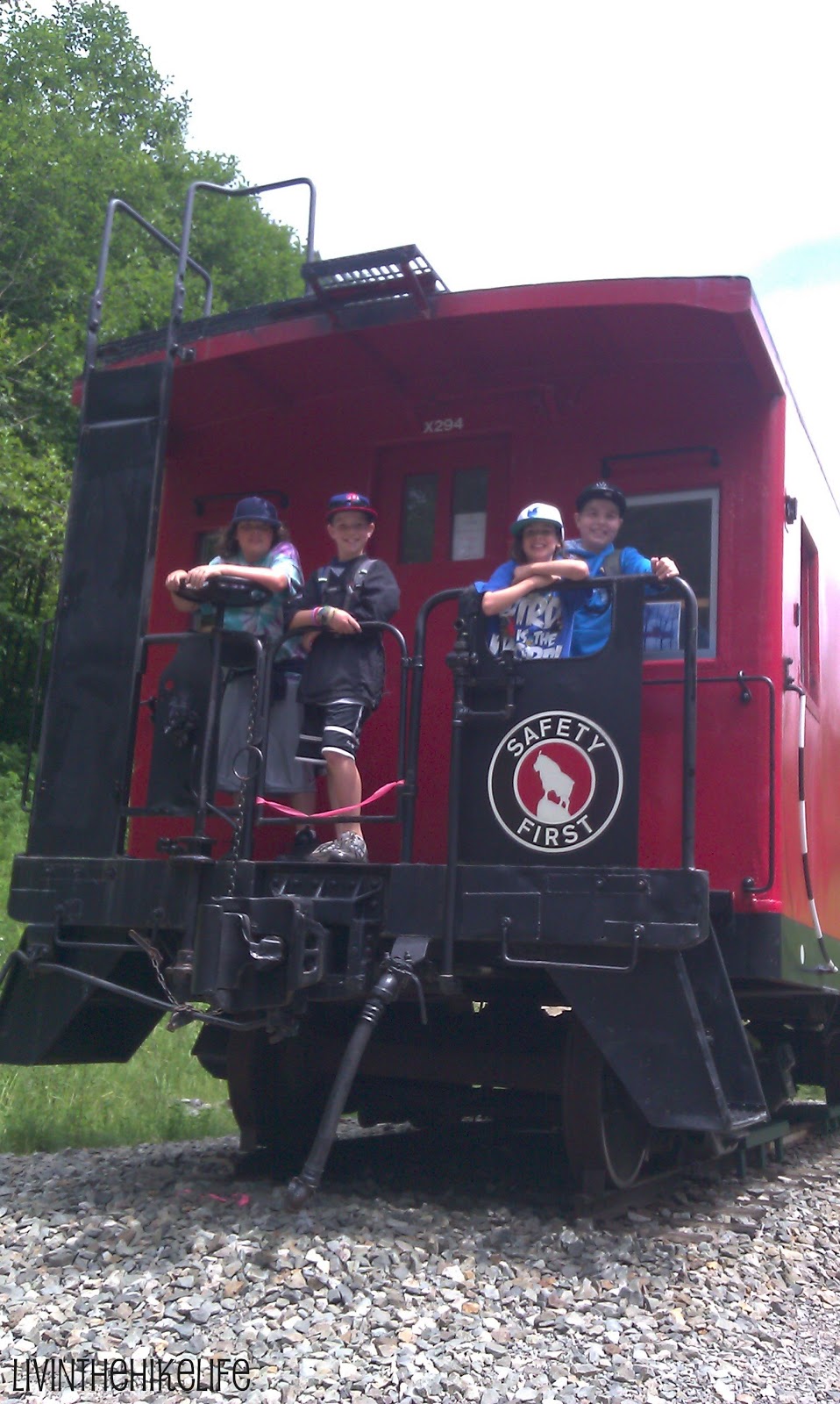
The above directions go to the trailhead we parked at and we liked this way the best. You hit the turnaround at the caboose and the kids enjoyed playing on it before we turned around and hiked back.
You do need a wilderness pass to park here. You will want to stop at the Skykomish Ranger Station on your way. The pass is $5 and is good for the day. You can buy a yearly pass which is $30.
There is a bathroom at the ranger station and at the trailhead and turnaround for those of you with children (who are we kidding, moms too).
Be sure to check out this link USDA forest service website before you head out to make sure trail conditions are good. Many of these trails are only accessible May-October.
http://www.irongoat.org/ . It is pretty interesting.
We went with another mom and her 2 boys which makes it more fun for the kids that they get to go with their friends. This was more of a walk through the woods rather than a hike since it was pretty near flat the entire way, but it was beautiful and about 6 miles round trip. We actually went to the first trailhead turnoff when we were supposed to go to the second one that is marked with a red train caboose. This makes sense since the trail is an old railroad tunnel. Parts of the tunnel are still there and they are amazing! This is a great hike to do on a hot day since you can feel the cool breeze from the exposed tunnels and the cold air from the access tunnels.
This trail is easy for small children and stroller and wheelchair accessible. There was one small 6 ft section that still had a bit of snow, but the rest is flat and well maintained. Actually the day we were there, a maintenance crew was weedwacking and clearing the path to keep the path well maintained. Not as peaceful, but much appreciated.
To get here take the Stevens Pass Highway, U.S. 2, to Milepost 55, 6 miles east of the town of Skykomish or to Milepost 58.3 at Scenic (5.6 miles west of the summit). Turn north on to the Old Cascade Highway, U.S. Forest Service (USFS) Road #67. Proceed to the junction with USFS Road #6710 (2.3 miles from Milepost 55 or 1.4 miles from Milepost 58.3). Turn onto USFS Road #6710 and proceed 1.4 miles to the Martin Creek trailhead parking lot.
The above directions go to the trailhead we parked at and we liked this way the best. You hit the turnaround at the caboose and the kids enjoyed playing on it before we turned around and hiked back.
You do need a wilderness pass to park here. You will want to stop at the Skykomish Ranger Station on your way. The pass is $5 and is good for the day. You can buy a yearly pass which is $30.
There is a bathroom at the ranger station and at the trailhead and turnaround for those of you with children (who are we kidding, moms too).
Be sure to check out this link USDA forest service website before you head out to make sure trail conditions are good. Many of these trails are only accessible May-October.
Subscribe to:
Posts (Atom)